St. Andrew’s Church Cemetery

St Andrew’s Church and Cemetery are shown in this early 1900s picture postcard of Richmondtown (NYPL)

One of Staten Island’s most picturesque sites is found where Old Mill Road bends into Richmond Hill Road in the Richmondtown section of the island. Here a low stone wall separates the busy roadway from the charming Church of St. Andrew and its rolling churchyard cemetery. Reminiscent of a 12th-century English Norman parish church, St. Andrew’s was established in 1705 as Staten Island’s first English-speaking congregation and received an official charter from Queen Anne in 1712. The original stone church was completed in 1712; over the next century and a half it was damaged by fires and rebuilt several times. Finally, in 1872, the present church was constructed using the original stone walls. The property is situated in a secluded, wooded setting on a rise of land just north of Richmond Creek.

An 1874 atlas of Staten Island depicts St. Andrew’s location at the edge of the historic village of Richmond.

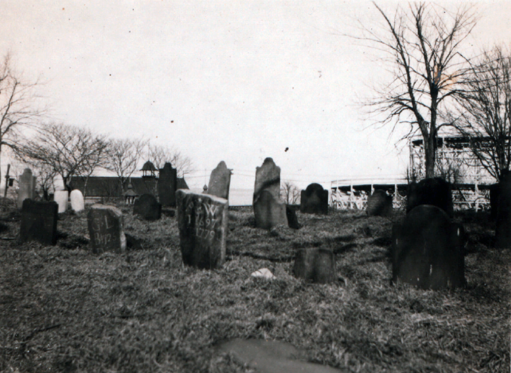
Surrounding the church building is the parish cemetery with many gravestones dating back to the Colonial period; the oldest is dated 1733. Surnames on the early gravestones include those of the area’s English settlers as well as the Dutch and French families who joined the Episcopal church. Among the notable burials is the family plot holding the remains of several relatives of Elizabeth Ann Seton, the first U.S. citizen canonized by the Catholic Church. Seton’s maternal grandfather, Rev. Richard Charlton (an early rector of St. Andrew’s) is interred here, as is her father, Dr. Richard Bayley, and her brother and sister.

A view of tombstones in St. Andrew’s Church Cemetery, April 2017 (Mary French)

Dr. Bayley was a prominent physician and his tombstone inscription is of particular historical interest. It reads: “after practicing the various branches of his Profession, with unwearied diligence and high reputation for 30 years in that City, projected the plan, and for 5 years conducted the operations of a Lazaretto on this island. Intelligent in devising and indefatigable in pursuing plans subservient to the cause of humanity, he continued to guard the public health with persevering industry, and in the midst of danger, to perform with invincible fortitude, the hazardous duties of Health Officer, until in the discharge of this important trust, he was seized with a malignant fever to which he fell a lamented victim, and thus terminated a life of great usefulness, on the 17th day of August 1801, aged 56 years.”  The “Lazaretto” referred to here was the Quarantine station at Tompkinsville, which Bayley was in charge of from 1796 until he died of yellow fever contracted while caring for immigrant patients in 1801.

Over a thousand individuals have been laid to rest in St. Andrew’s Church Cemetery, which was enlarged in 1911 by the purchase of an old hotel property that was between the church site and Richmond Creek. This section of the cemetery opened for burials in 1924 and is still in use for new interments by the thriving parish of St. Andrew’s. Also in active use is the property’s newest addition—the Cemetery for All God’s Creatures, which is located at the back of the historic churchyard. Created by the church in 2004, the Cemetery of All God’s Creatures has 800 plots for the remains of animal companions and is the only pet cemetery within the five boroughs of New York City.

Markers in the pet cemetery at St. Andrew’s Church Cemetery, April 2017 (Mary French)
A 2020 aerial view of St. Andrew’s Church and Cemetery (NYCNow&Then)

View more photos of St. Andrew’s Church Cemetery

Sources: Beers 1874 Atlas of Staten Island, Sec 20; The Church of St. Andrew, Richmond, Staten Island: Its History, Vital Records, and Gravestone Inscriptions (Davis et al 1925); The Church of St. Andrew Designation Report, (Landmarks Preservation Commission 1967); Church of St. Andrew, Arthur Kill, Richmond Town, NY (NY State Cultural Information System National Register Inventory Data, 2002); Realms of History: The Cemeteries of Staten Island (Salmon 2006); “Staten Island Pet Cemetery Helps Animal Lovers Find Comfort Amid Grief,” Staten Island Advance, Nov 1, 2011; The Church of St. Andrew

Luyster Cemetery

A view of Luyster Cemetery in 1925 (NYPL)

In 1938, an old Dutch cemetery was demolished to make way for the expansion of the North Beach Airport—today’s LaGuardia Airport—in Queens. The small graveyard was situated on a bluff overlooking the waters of Bowery Bay, on land that had once been part of a vast estate established by Pieter Cornelisz Luyster in 1668. Pieter Luyster was a carpenter who emigrated from Holland in 1656 and was the progenitor of the Luyster family in America. After he died in 1695, the Luyster estate at Bowery Bay remained in the family for more than a century, each generation burying deceased relatives and friends in the hilltop burial ground.

By the mid-1800s, the Luyster estate had been divided into half a dozen farms that passed into other hands. In the 1870s, piano manufacturer William Steinway partnered with brewer George Ehret to acquire a large section of the old Luyster lands along the shore of Bowery Bay and in 1886 opened a pleasure garden and beach there. Reaching its peak between 1895 and 1915, Bowery Bay Beach (later called North Beach) offered swimming and boating facilities, picnic grounds, and restaurants, as well as  carousels, a Ferris wheel, roller coasters, and other attractions.

A 1903 insurance map shows the location of Luyster Cemetery within the North Beach recreational area

For decades, the Luyster Cemetery stood within this “Coney Island of Queens” and was frequently encountered by the recreation area’s visitors. Several early 20th-century newspaper articles describe the graveyard, which was a small square plot with apple trees at each corner offering protection to four rows of headstones. In 1903, the New York Times noted that the cemetery was between a roller coaster and a dance hall and that “picnickers camp among the stones and scatter their luncheon crumbs over the sod.”  

In 1919, the Queens Topographical Bureau recorded inscriptions found on the 36 headstones still present in the Luyster Cemetery at that time. Many of the headstones were brownstone, while some were of marble and others simply rough fieldstones marked only with initials and years of birth and death. The earliest identifiable grave in the burial ground was that of Mary Luyster Rapelye (1696-1732), a granddaughter of emigrant forefather Pieter Cornelisz Luyster. The latest was that of Martin Rapelye, who died at age 81 in 1816. Most of the tombstones marked the resting places of other members of the Luyster and Rapelye families.

Another view of Luyster Cemetery in 1925 (NYPL)

World War I and the passing of Prohibition in 1919 brought an end to the pleasure grounds at North Beach and by the 1930s the lonely little Luyster Cemetery stood among the the rotting structures that once housed its amusements. Before the area was redeveloped for the airport expansion in 1938, the Docks Commissioner arranged for the removal of the remains from the Luyster Cemetery to a plot at nearby St. Michael’s Cemetery. The last of the bodies were moved in May 1938. Today the former site of the Luyster Cemetery is near the west boundary of the LaGuardia Airport complex.

Location of Luyster Cemetery as surveyed by the Queens Topographical Bureau in 1919
A 2022 satellite view of the western edge of the LaGuardia Airport complex with arrow denoting the approximate location of the former site of the Luyster Cemetery (Google Earth)

Sources: Sanborn’s 1903 Insurance Maps of the Borough of Queens, Vol 5 Pl 1; The Annals of Newtown (Riker 1852); History of Queens County (Munsell 1882); Description of Private and Family Cemeteries in the Borough of Queens (Powell & Meigs 1932); “The Luyster Burial Place,” Newtown Register, Jun 7, 1900; “Some Old Graves in North Beach,” Greenpoint Weekly Star, Aug 30, 1902; “Picnic in a Graveyard,” New York Times, Aug 3, 1903; “Graves Dug 200 Years Ago,” Brooklyn Daily Eagle, Sep 28, 1907; “North Beach Pleasure Seekers Keep Sacred Old Graveyard of Rapelye and Luyster Families,” Daily Star (Long Island City, NY), Aug 1, 1924; “Old North Beach Resort to Become Part of New Jackson Heights Airport,” Daily Star (Long Island City, NY), Feb 5, 1929; “Old North Beach Burying Ground May Vanish to Make Way for Airport,” Daily Star (Long Island City, NY), Feb 7, 1929; “Old Cemetery to Be Dug Up,” Long Island Daiy Press, Apr 30, 1938; “At City Hall,” New York Post, May 4, 1938

Bergen Family Burial Ground

The Bergen family burial ground shown on an 1850s map.

In June of 1874, there was great excitement in the Brooklyn neighborhood now known as Sunset Park when a police officer named George Zundt uncovered human remains while excavating for a cesspool at the home he had recently moved into on 40th Street between Third and Fourth Avenues. Among the remains, which included two skulls (“to which hair still adheres,” a local newspaper reported) and other bones, Officer Zundt found a coffin plate with the following inscription: “Catharine Crabb, Aged 71, Died March 17, 1839.”

A photo of the DeHart-Bergen House that stood just west of the Bergen family burial ground near Gowanus Bay, taken before the building was demolished in 1891 (NYPL)

It turned out that Zundt’s new home was on the site of an old burial ground that had been part of the homestead farm of Simon Bergen (1768-1830). A descendant of one of the area’s earliest Dutch settlers, Simon Bergen owned the northeasterly half of what had once been the 300-acre DeHart plantation near Gowanus Bay. Bergen’s father, also named Simon Bergen (1746-1777), and his grandfather, Johannes Bergen (1721-1786), each married members of the DeHart family, and thus the DeHart farm came to be owned by the Bergens. After the untimely demise of the elder Simon Bergen at age 31 (from wounds inflicted by a misfired musket he was considering purchasing) the farm was divided between his sons Simon and John. Simon retained that portion of the property that included the DeHart-Bergen House. Built in the 1670s, the DeHart-Bergen House stood west of Third Avenue near 37th Street, overlooking Gowanus Bay.

The Bergen family burial ground and surrounding farmland on an 1850s property map covering that area of modern-day Sunset Park

Just east of the ancient DeHart-Bergen House was the Bergen family burial ground, situated in the middle of the block bounded by 39th and 40th Streets and Third and Fourth Avenues. Several 19th-century property maps and land records define the cemetery, which was “forty-nine feet from north to south and ninety-four feet from east to west” and surrounded by a stone wall. In an 1827 deed, Simon Bergen conveyed the plot to John S. Bergen, Jacob Bergen, Peter Bergen, Cornelius Bergen, Theodorus Bergen, Leffert Bergen, Garret Bergen, and John T. Bergen, and their descendants, for burial purposes forever, and reserved the perpetual right for burial for himself and his descendants.

The homestead burial ground was probably used from the late 1700s until the 1840s when Bergen descendants began to move the remains of their family members to plots at nearby Greenwood Cemetery. After Simon Bergen’s death, his farm was divided between his daughters Leah Morris and Gashe Lott, who sold the land out of the family.

A 1903 map shows redevelopment of the Bergen family burial ground with the former cemetery and old farm lines denoted.

By the late 1860s, most of the remains had been removed from the old Bergen family burial ground, and the property around it had been broken into building lots. The site’s use as a cemetery had not yet been forgotten, however. In 1870, the Brooklyn Daily Eagle reported that local police had visited the old Bergen family burial ground at 39th and 40th Streets to investigate a new grave that had been made at the site without authorization. Finding the fresh mound, officers exhumed a small pine coffin that contained the corpse of an infant only a few days old. Murder was suspected based on contusions found on the infant’s body.

This 1870 mystery is the last that is known of the Bergen family cemetery until after it had been redeveloped and was uncovered again in 1874 by Officer Zundt’s home improvement project. No records have been found to identify the Catharine Crabb whose coffin plate was retrieved among the bones uncovered in 1874, or to explain why she was buried in the Bergen family graveyard. Today, homes still stand on the former site of the Bergen family burial ground.

A 2022 Google Earth satellite view of the former site of the Bergen family burial ground in Sunset Park Brooklyn; arrow denotes approximate location of the site.

Sources: 8th Ward from 26th St. to 42nd St, [185?], Map, Bergen-[185-?]c.Fl; Map Collection, Brooklyn Public Library, Center for Brooklyn History; Hyde 1903 Atlas of the Borough of Brooklyn, Vol 1, Pl 33; Kings County Conveyances, Vol 26 p3-4, “United States, New York Land Records, 1630-1975,” FamilySearch; The Bergen Family; or the Descendants of Hans Hansen Bergen, one of the Early Settlers of New York and Brooklyn, L.I. (Bergen 1876); “Legal Notices,” Brooklyn Daily Eagle, Sep 15, 1864; “Supposed Child-Murder,” Brooklyn Daily Eagle, Feb 14, 1870; “Disturbing the Remains of the Dead,” Brooklyn Times Union, Jun 4, 1874; Prepare for Death and Follow Me:”An Archaeological Survey of the Historic Period Cemeteries of New York City (Meade 2020)

41st Street Reformed Presbyterian Church Cemetery

This detail from a modern map overlaid with an 1852 map of Manhattan shows the 41st Street Reformed Presbyterian Cemetery that existed in the mid-19th century and the Port Authority Bus Terminal ramps that cover the site today.

The Port Authority Bus Terminal in Manhattan is the busiest bus station in the world, with a quarter of a million commuters and intercity passengers arriving or departing via 8,000 buses on a typical weekday. Located on Eighth Avenue between 40th and 42nd streets in Midtown, the terminal has a unique ramp system that provides a direct connection to the Lincoln Tunnel. These ramps are built over the site where the 41st Street Reformed Presbyterian Church Cemetery once existed.

The Reformed Presbyterian Church Cemetery, approximately 125 feet wide and 100 feet deep, was located 100 feet west of Ninth Avenue on the south side of West 41st Street. The property was acquired for use as a burial ground in 1832, by three elders of the Reformed Presbyterian Church. The Reformed Presbyterian Church is a small denomination that originated in Scotland in 1690 when its members refused to become part of the national Church of Scotland.

The Reformed Presbyterian Church Cemetery in 1854.

The first Reformed Presbyterian congregation in New York City was organized in 1797 and had a church on Chambers Street in downtown Manhattan; in 1830 members living further uptown incorporated as the Second Reformed Presbyterian congregation and acquired a church at 166 Waverly Street in Greenwich Village; in 1848, part of this congregation split to form the Third Reformed Presbyterian congregation. After the 1848 split, the Third congregation remained at the Waverly Street location while the Second congregation erected a church on 11th Street near Sixth Avenue. Records show the 41st Street cemetery was used by both the Second and Third Reformed Presbyterian congregations, which collectively had about 500 members.

An 1856 notice of the removal of the 41st Street Reformed Presbyterian Cemetery

No records have been found to tell us how many people were interred in the Reformed Presbyterian Cemetery on 41st Street, or the names of those who were laid to rest there during the two-and-a-half decades it was utilized for burials. In October of 1856, church trustees removed the remains of those interred in the 41st Street burial ground to Machpelah Cemetery in what is now North Bergen, New Jersey.

In 1858, the Trustees of the Second and Third Reformed Presbyterian congregations sold the cemetery property and it was redeveloped. In 1890, the location of the former cemetery was occupied by a rag warehouse and other structures. Construction of the Port Authority Bus Terminal began in the late 1940s. Today, the piers supporting the ramp system, and several buildings beneath the ramps, stand on the former site of the 41st Street Reformed Presbyterian Cemetery.

A 2021 view of the ramps and other structures that cover the former site of the 41st Street Reformed Presbyterian Cemetery (Michael Young)

Sources: Dripps’ 1852 Map of the City of New-York extending northward to Fiftieth St; Perris’ 1854 Maps of the City of New York, Vol 7 Pl 97; “Special Notices,” New York Herald, Oct 10, 1856; “City Items—A Burying Ground Closed,” New York Daily Tribune, Oct 16, 1856; “City Intelligence—Removing the Dead,” New York Herald, Oct 17, 1856; History of the Reformed Presbyterian Church in America (Glasgow 1888); Archaeological Documentary Study, No. 7 Line Extension/Hudson Yards Rezoning (Parsons Brinckerhoff et al 2004);  Prepare for Death and Follow Me:”An Archaeological Survey of the Historic Period Cemeteries of New York City (Meade 2020); “A New Port Authority Bus Terminal in New York,” TR News 31 Nov-Dec 2017; “Port Authority Bus Terminal to Receive Multi-Billion-Dollar Overhaul in Midtown Manhattan,” New York YIMBY, Feb 1, 2021

Port Richmond Reformed Dutch Church Cemetery

This vintage postcard shows the Port Richmond Reformed Church as it appeared in the early 1900s. Parts of the north and south cemetery sections can be seen on either side of the church (NYPL)

The Reformed Church at Port Richmond is home to the earliest congregation on Staten Island and its surrounding cemetery includes the Island’s oldest public burial ground. Situated just south of the busy intersection of Port Richmond Avenue and Richmond Terrace, this picturesque site—landmarked by the City of New York in 2010—features attractive lawns, historical buildings, artistically significant monuments, and graves of the North Shore’s early Dutch settler families.

In 1715, the Reformed Protestant Dutch Church congregation built their first house of worship at this site, next to the graveyard that had already been in use for at least a decade. Thought to have originated as a private burial ground for the Corson family in the 1690s, the graveyard is referred to in official documents as “the burying place” as early as 1705 and became the burial ground for most families on the North Shore during the 18th century. During the 19th century, the church acquired more land adjacent to the church to expand its burial grounds.

An 1853 map shows the Reformed Dutch Church and cemetery grounds at Port Richmond.

The present church at this site is the congregation’s third, built in 1844. This Greek Revival-style building was enlarged in 1898 with a Sunday school wing added on the south side of the church. The surrounding cemetery is divided into three sections to the north, south, and west of the building complex.

Tombstone of Mary Van Pelt (Richard Arthur Norton, June 2006)

The cemetery section to the north of the church is the oldest and incorporates the original public burial ground of the North Shore’s Dutch settlers. This section is notable for including several finely carved brown and red sandstone gravemarkers that have been ascribed to the workshops of significant New Jersey stone carvers. Of the 224 gravestones here, the oldest with a legible inscription is that of Mary Van Pelt, who died in 1746 at age 15. Her red sandstone marker is topped with a winged death’s head in a style attributed to the “Common Jersey Carver,” an anonymous artisan whose work, dating from the 1720s to 1760s, is well represented in northern New Jersey communities. Other sandstone markers in this section of the cemetery are attributed to carver Ebenezer Price, the most prominent 18th-century stonecutter in the New York-New Jersey region.

The small cemetery section to the south of the church occupies land donated by Daniel Tompkins in 1816 and includes 105 gravestones dating between 1816 and 1896. Most of the monuments here are marble and mark the graves of members of families such as the Tysons, Merseraus, Jacques, Sinclairs, Haughwouts, Crocherons, Housmans, and Posts. The 1898 Sunday school annex was built over part of this south cemetery; some graves were moved at this time but several rows of graves were left in place and remain beneath the crawl space of the the wing.

A view of the south section of the Port Reformed Church Cemetery, April 2017 (Mary French)

The third cemetery section, not visible from the street, is located behind the Sunday school wing on land purchased in 1833 (and expanded in the 1870s) by the Reformed Church to provide for future burial needs. The 363 markers here, mostly of marble or granite, date between 1834 and 1916. Notable here is the grave of congressman and state senator Judge Jacob Tyson (1773-1848) and the family plots of the Van Name, Houseman, Drake, Kholer, and Post families.

Although the Port Richmond Reformed Church is still an active congregation, no interments have been made in their cemetery grounds for over a century. Historically, the church served as a hub for the Port Richmond community that grew and was built around it. The generations of Staten Islanders that are laid to rest in the church’s grounds are part of this legacy.

A view of the north section of the Port Reformed Church Cemetery, April 2017 (Mary French)

This 2012 aerial image shows Reformed Church building and cemetery grounds on the west side of Port Richmond Avenue, just south of Richmond Terrace (NYCityMap)

Sources: Butler’s 1853 Map of Staten Island; Fairchild Cemetery Manual (1910); “History of the Reformed Church on Staten Island,” Staten Island Historian 16(1) Jan-March 1955; Realms of History: The Cemeteries of Staten Island (Salmon 2006); Reformed Church on Staten Island, Sunday School Building, and Cemetery Designation Report, (Landmarks Preservation Commission 2010); Reformed Church on Staten Island

© Mary French 2010-2024